Toms Run Shelter
Toms Run shelter is located 1.1 miles south of Michaux Road, a short distance south of the AT midpoint sign and just before crossing Toms Run. We pass this shelter during the PA AT #4 hike and usually take our lunch break here. There is one shelter lean-to, with a picnic table in front of it, another table under a covered pavilion a short distance uphill and a few more tables scattered around the site. There is signage to a privy uphill of the shelter. There is also signage to a spring uphill from the shelter, but most people were getting water directly from Toms Run.
Built 1988/89 by Youth Conservation Corps (replaced earlier structures built 1935)
Next shelter NB: James Fry shelter, 11.1 miles
Next shelter SB: Birch Run shelter, 6.3 miles
Distance - 3.3 mi
Time - 1:20
Total Ascent - 284 ft
Total Descent - 254 ft
Max Elevation - 938 ft
Min Elevation - 812 ft
I parked on Michaux Road, at the ruins of an old barn near Camp Michaux. I walked uphill along the road to the AT crossing, then south on the AT to the shelter, passing the AT midpoint sign along the way. I returned by the same path, taking some extra time to explore the barn ruins.
Built 1988/89 by Youth Conservation Corps (replaced earlier structures built 1935)
Next shelter NB: James Fry shelter, 11.1 miles
Next shelter SB: Birch Run shelter, 6.3 miles
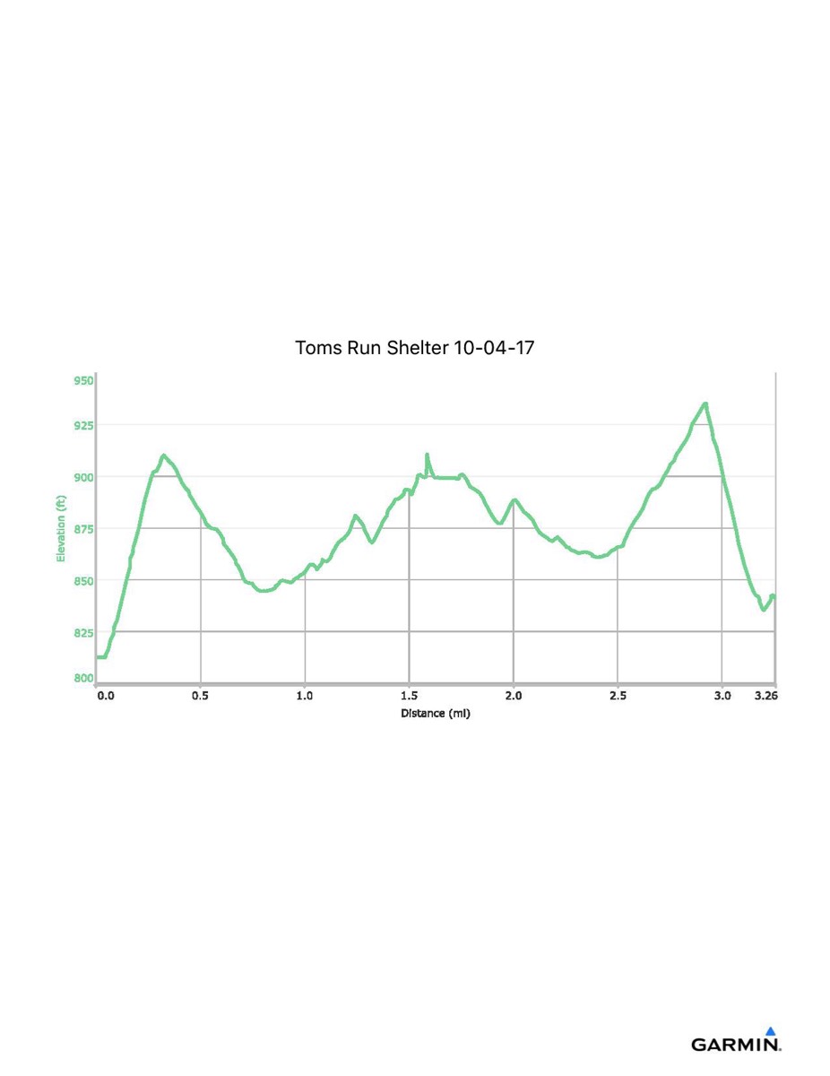
Distance - 3.3 mi
Time - 1:20
Total Ascent - 284 ft
Total Descent - 254 ft
Max Elevation - 938 ft
Min Elevation - 812 ft
I parked on Michaux Road, at the ruins of an old barn near Camp Michaux. I walked uphill along the road to the AT crossing, then south on the AT to the shelter, passing the AT midpoint sign along the way. I returned by the same path, taking some extra time to explore the barn ruins.