Sam Moore Shelter
The turnoff for Sam Moore shelter is located about 3.6 miles south of VA 7 and 3.2 miles north of VA 605 (Morgans Mill Rd), in the trail section known as the "Roller Coaster". The turnoff is just south of a stream crossing (Spout Run). The shelter is about 100 yards east off the trail. We pass this shelter during the VA AT #3 hike and usually have lunch here. There is one lean-to structure, as well as a covered picnic table, a fire circle, a bear pole and a few tent spaces. The privy is located a short distance uphill behind the shelter. Nearby Sawmill Spring provide a dependable water supply.
Built 1990
Next shelter NB: David Lesser shelter, 14.1 miles
Next shelter SB: Rod Hollow shelter, 6.9 miles
Distance - 8.9 mi
Time - 5:21
Total Ascent - 2205 ft
Total Descent - 2226 ft
Max Elevation - 1291 ft
Min Elevation - 697 ft
I parked at the VA 7 parking lot and walked along the (very muddy) blue trail to the AT, then south along the trail to the shelter. Returning, I chose to avoid the mud by following the AT all the way to VA 7, then walking along the road back to the parking lot.
Built 1990
Next shelter NB: David Lesser shelter, 14.1 miles
Next shelter SB: Rod Hollow shelter, 6.9 miles
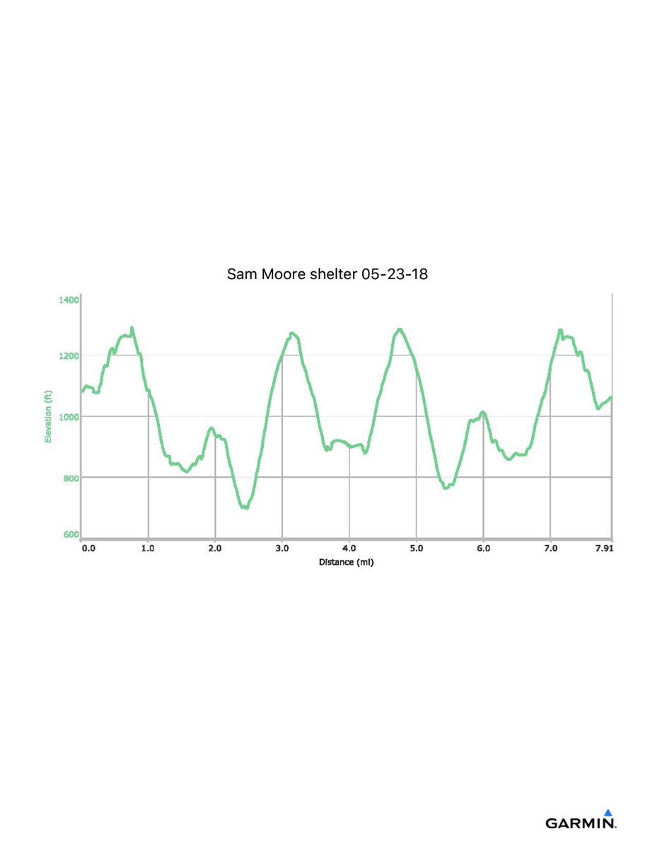
Distance - 8.9 mi
Time - 5:21
Total Ascent - 2205 ft
Total Descent - 2226 ft
Max Elevation - 1291 ft
Min Elevation - 697 ft
I parked at the VA 7 parking lot and walked along the (very muddy) blue trail to the AT, then south along the trail to the shelter. Returning, I chose to avoid the mud by following the AT all the way to VA 7, then walking along the road back to the parking lot.