Jim & Molly Denton Shelter
The Jim & Molly Denton shelter is located about 3 miles south of VA Rt 55. The shelter is about 50 yards west off the trail. We pass this shelter during the VA AT #7 hike. That hike was only ever done as an overnight outing and has not been done since the overnights were discontinued. We would normally eat lunch at this shelter. There is one large building with an open porch that has a bench and a triple-adirondack-chair. There is also a separate covered picnic table, a fire pit, a horseshoe pit, and a gravity-powered shower. The elevated, composting privy is located a short distance from the shelter. The spring is located at a signed turnoff a short distance south of the shelter along the AT. A short distance north of the shelter, there is an old metal roof in the woods which may have come from a previous shelter.
Next shelter NB: Manassas Gap shelter, 5.5 miles
Next shelter SB: Tom Floyd Wayside shelter, 8.1 miles (not included in this collection)
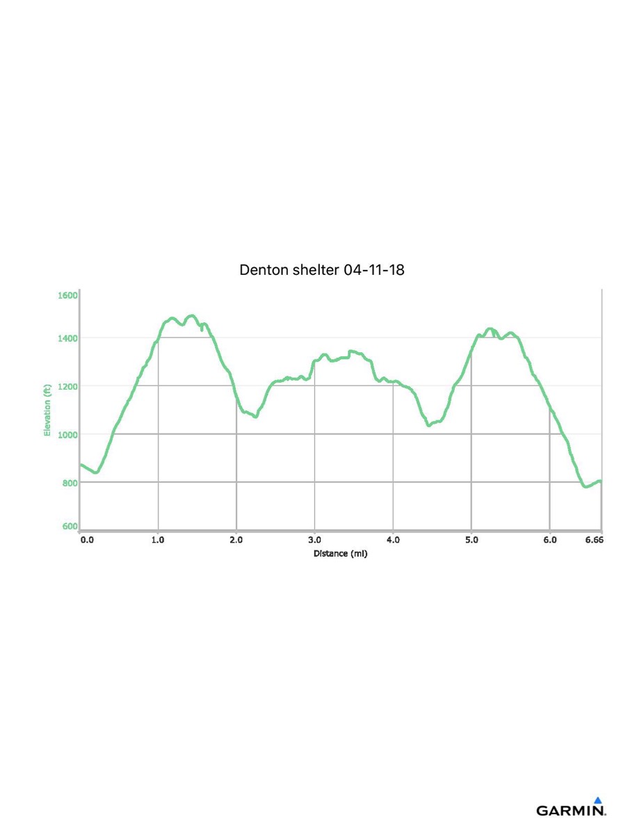
Distance - 7.1 mi
Time - 3:49
Total Ascent - 1535 ft
Total Descent - 1608 ft
Max Elevation - 1493 ft
Min Elevation - 779 ft
I parked at Tucker Lane AT parking (VA 725, just north of VA 55) and walked south along the trail to the shelter.
Next shelter NB: Manassas Gap shelter, 5.5 miles
Next shelter SB: Tom Floyd Wayside shelter, 8.1 miles (not included in this collection)
Distance - 7.1 mi
Time - 3:49
Total Ascent - 1535 ft
Total Descent - 1608 ft
Max Elevation - 1493 ft
Min Elevation - 779 ft
I parked at Tucker Lane AT parking (VA 725, just north of VA 55) and walked south along the trail to the shelter.