Dicks Dome and Whiskey Hollow Shelters
The turnoff for Dicks Dome and Whiskey Hollow shelters is located about 4.9 miles south of US 50 (Ashby Gap). Dicks Dome shelter is about 0.2 mile east off the trail. The newer Whiskey Hollow shelter is located at the same site, about 100 yards east of Dicks Dome. We pass these shelters during the VA AT #5 hike and typically have lunch here. Dicks Dome is a small plywood structure, built in a geodesic style unlike the lean-to form of most other AT shelters. It has a picnic table and not much else. Whiiskey Hollow shelter is a more typical lean-to structure, not large, but with two sleeping levels, a picnic table on its covered porch, and a fire circle in front of the shelter. The old-style privy is located a short distance uphill behind Dicks Dome. The large stream that you cross to enter the site serves as the water source for the shelters.
Dicks Dome was built by an AT member on private land that was later donated to the AT. Whiskey Hollow shelter was built in 2017 as a replacement for the aging and small Dicks Dome. I do not know whether Dicks Dome is still there, but it is no longer listed in the AT GIS database of AT features. Needs a revisit!
Next shelter NB: Rod Hollow shelter, 8.5 miles
Next shelter SB: Manassas Gap shelter, 4.4 miles
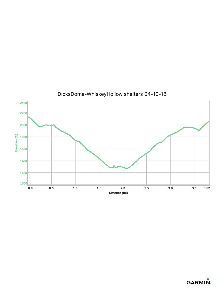
Distance - 3.8 mi
Time - 1:58
Total Ascent - 939 ft
Total Descent - 1010 ft
Max Elevation - 2135 ft
Min Elevation - 1274 ft
note: this track data was extracted from the combined hike here and to Manassas Gap shelter. The numbers may not be exact.
I parked at Freezeland Road (VA 638) and walked along the blue trail to the AT, then north along the trail to the shelters. I also visited Manassas Gap shelter on this outing. This parking is no longer available and a future visit would have to begin from the Ridge parking area to the north.
Dicks Dome was built by an AT member on private land that was later donated to the AT. Whiskey Hollow shelter was built in 2017 as a replacement for the aging and small Dicks Dome. I do not know whether Dicks Dome is still there, but it is no longer listed in the AT GIS database of AT features. Needs a revisit!
Next shelter NB: Rod Hollow shelter, 8.5 miles
Next shelter SB: Manassas Gap shelter, 4.4 miles
Distance - 3.8 mi
Time - 1:58
Total Ascent - 939 ft
Total Descent - 1010 ft
Max Elevation - 2135 ft
Min Elevation - 1274 ft
note: this track data was extracted from the combined hike here and to Manassas Gap shelter. The numbers may not be exact.
I parked at Freezeland Road (VA 638) and walked along the blue trail to the AT, then north along the trail to the shelters. I also visited Manassas Gap shelter on this outing. This parking is no longer available and a future visit would have to begin from the Ridge parking area to the north.