Rocky Mountain Shelter
The turnoff for Rocky Mountain shelter is located about 1.7 miles north of the AT crossing of PA Rt 233. The shelter is about 0.3 miles off the trail and about 140 feet downhill. We pass this shelter during the PA AT #2 hike and have lunch here. There are two lean-to structures with a picnic table, two fire rings and one fire grate. The privy is just beyond the shelter, past a bear box. The marked trail to the spring leads about 0.2 miles from the shelter and 130 feet further downhill. After that long descent, it was disappointing to find just a small puddle of muddy water. In fact, the spring is just a short distance from Rt 233 and I seriously considered just road walking back to my car, but I bit the bullet and climbed the 270 feet back up to the AT and returned along the trail.
Built 1988/89 by Youth Conservation Corps
Next shelter NB: Quarry Gap shelter, 5.7 miles
Next shelter SB: Tumbling Run shelter, 6.6 miles
Distance - 4.1 mi
Time - 1:47
Total Ascent - 720 ft
Total Descent - 714 ft
Max Elevation - 1152 ft
Min Elevation - 761 ft
I parked at a small parking area where the AT crosses PA Rt 233 and walked north along the trail to the shelter. Our normal starting point for PA AT #2 is on Snowy Mountain Road, about 2.7 miles further south.
Built 1988/89 by Youth Conservation Corps
Next shelter NB: Quarry Gap shelter, 5.7 miles
Next shelter SB: Tumbling Run shelter, 6.6 miles
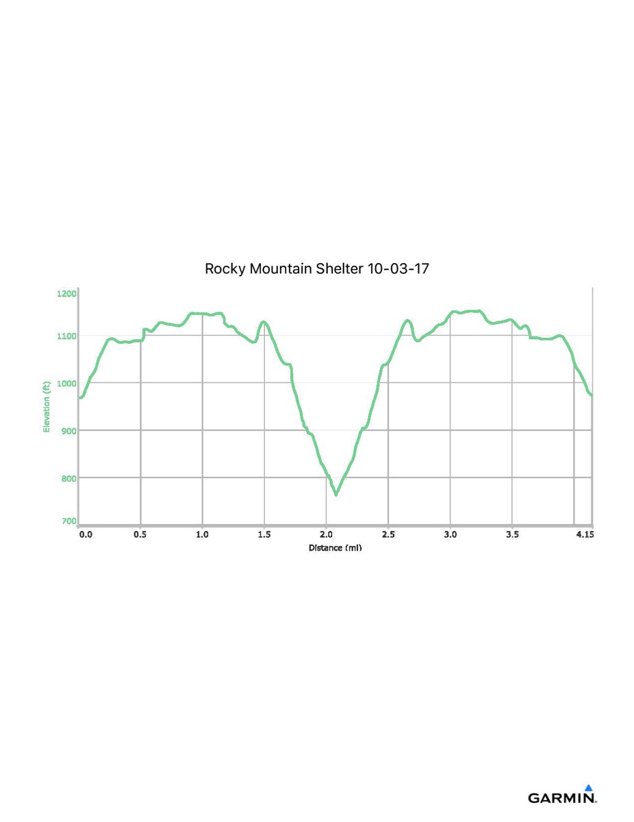
Distance - 4.1 mi
Time - 1:47
Total Ascent - 720 ft
Total Descent - 714 ft
Max Elevation - 1152 ft
Min Elevation - 761 ft
I parked at a small parking area where the AT crosses PA Rt 233 and walked north along the trail to the shelter. Our normal starting point for PA AT #2 is on Snowy Mountain Road, about 2.7 miles further south.