Ed Garvey Shelter
The turnoff for Ed Garvey shelter is located about 3.7 miles south of Gapland Road/Gathland State Park. The shelter is about 100 yards east off the trail. We pass this shelter during the MD AT #6 hike. Although it comes near the middle of the hike, we usually have just a short rest stop here before continuing to have lunch further down the trail at Weverton Cliffs. The shelter, another of the "new" Maryland shelters, is a modern, two-level structure with a stairway in back leading to the second sleeping level. There is a picnic table and bench on the porch, and several benches around a fire circle in front of the shelter. The elevated, composting privy is located a short distance from the shelter. Another, older privy is locked. A marked trail just beyond the fire circle leads steeply downhill to a piped spring.
Built 2002 by PATC
Next shelter NB: Crampton Gap shelter, 4.1 miles
Next shelter SB: David Lesser shelter, 15.6 miles
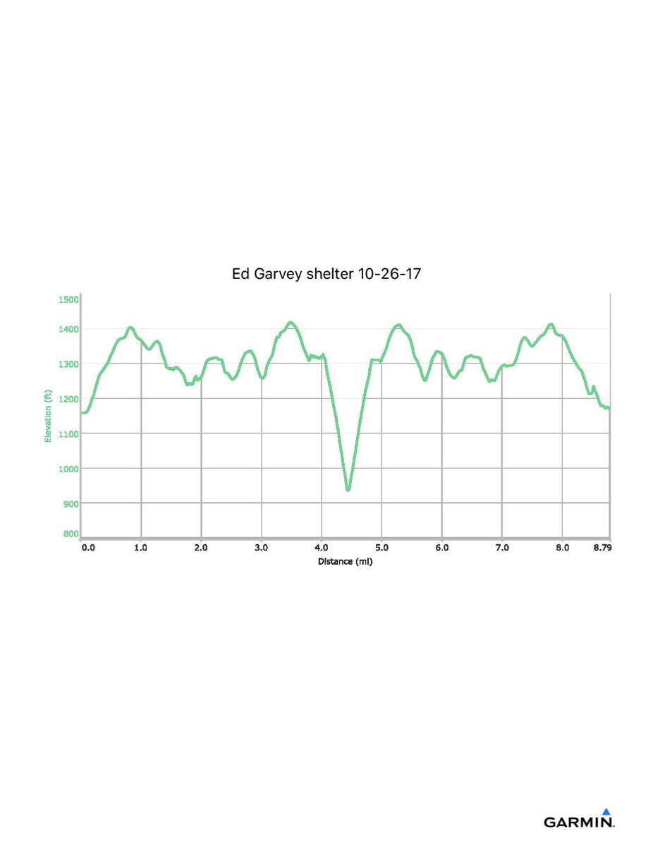
Distance - 9.5 mi
Time - 4:28
Total Ascent - 1486 ft
Total Descent - 1476 ft
Max Elevation - 1419 ft
Min Elevation - 935 ft
I parked at Gathland State Park and walked south along the trail to the shelter.
Built 2002 by PATC
Next shelter NB: Crampton Gap shelter, 4.1 miles
Next shelter SB: David Lesser shelter, 15.6 miles
Distance - 9.5 mi
Time - 4:28
Total Ascent - 1486 ft
Total Descent - 1476 ft
Max Elevation - 1419 ft
Min Elevation - 935 ft
I parked at Gathland State Park and walked south along the trail to the shelter.