Ensign Cowall Shelter
The Ensign Cowall shelter is located about 0.2 miles north of Wolfsville Road and is just a few yards off the trail. We pass this shelter during the MD AT #2 hike. As it comes so close to the end of the hike, we seldom stop here except to take photos. There is one large, two-level lean-to structure with a picnic table, several seating-logs and a fire circle. The privy is located a short distance to the right side of the shelter. An unmarked trail on the AT, about halfway back towards Wolfsville Road from the shelter leads a short distance to the spring. This shelter was the first of four "new" shelters built in Maryland over the last 20 years.
Built 1999 off-site by students from Gallaudet University from donated pine logs, then moved here.
Next shelter NB: Raven Rock shelter, 4.9 miles
Next shelter SB: Pine Knob shelter, 8.2 miles
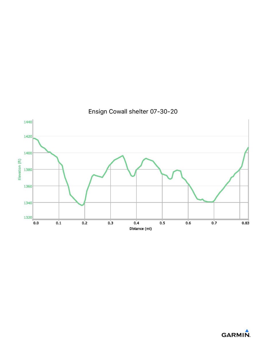
Distance - 0.8 mi
Time - 0:35
Total Ascent - 170 ft
Total Descent - 177 ft
Max Elevation - 1424 ft
Min Elevation - 1335 ft
I parked at the Wolfsville Road AT parking and walked the blue trail to the AT, then north along the trail to the shelter. Returning, I took the side trail to the spring before returning to the parking lot. This track shows some lateral drift and should be redone.
Built 1999 off-site by students from Gallaudet University from donated pine logs, then moved here.
Next shelter NB: Raven Rock shelter, 4.9 miles
Next shelter SB: Pine Knob shelter, 8.2 miles
Distance - 0.8 mi
Time - 0:35
Total Ascent - 170 ft
Total Descent - 177 ft
Max Elevation - 1424 ft
Min Elevation - 1335 ft
I parked at the Wolfsville Road AT parking and walked the blue trail to the AT, then north along the trail to the shelter. Returning, I took the side trail to the spring before returning to the parking lot. This track shows some lateral drift and should be redone.