Pine Knob Shelter
The turnoff for Pine Knob shelter is located about 0.5 miles north of I-70. There is a second turnoff about 0.1 mile further north along the trail. The shelter is about 0.1 mile west off the trail. We pass this shelter during the MD AT #3 hike. As it comes so late in this very long hike, and the shelter is not visible from the trail, we seldom even stop here. This older shelter has one small lean-to structure with a small utility table under its covered overhang. In front of the shelter and not under cover is a picnic table and a fire circle. There are several tent spaces along the path leading into the shelter area. The privy is located a short distance uphill from the shelter. A trail leads beyond the shelter to a piped spring.
Built 1939
Next shelter NB: Ensign Cowall shelter, 8.2 miles
Next shelter SB: Rocky Run shelter, 7.4 miles
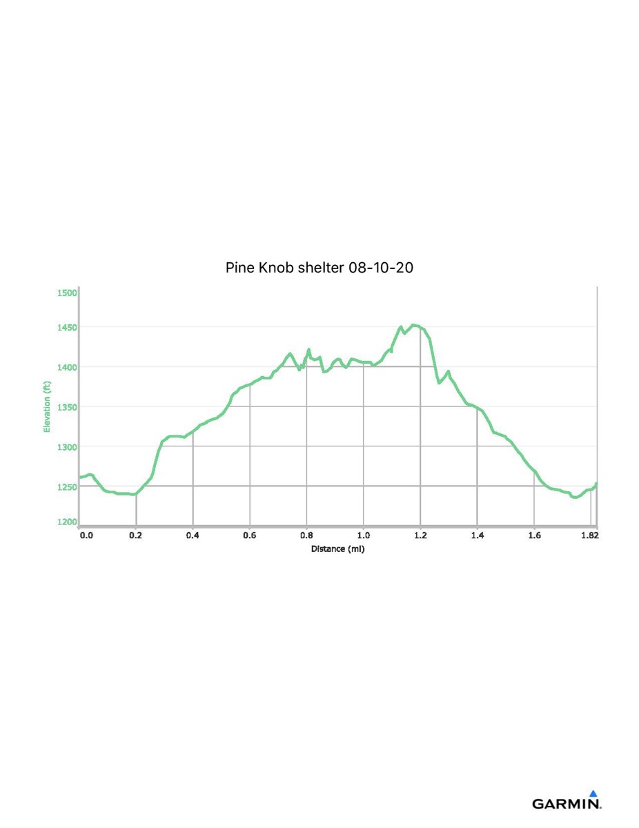
Distance - 1.8 mi
Time - 0:51
Total Ascent - 341 ft
Total Descent - 348 ft
Max Elevation - 1453 ft
Min Elevation - 1234 ft
I parked at US 40 AT parking and walked along the blue trail to the AT, then north along the trail to the shelter. After visiting the shelter, I continued further north along the trail to locate the second shelter access trail, which was not obvious from the shelter site.
Built 1939
Next shelter NB: Ensign Cowall shelter, 8.2 miles
Next shelter SB: Rocky Run shelter, 7.4 miles
Distance - 1.8 mi
Time - 0:51
Total Ascent - 341 ft
Total Descent - 348 ft
Max Elevation - 1453 ft
Min Elevation - 1234 ft
I parked at US 40 AT parking and walked along the blue trail to the AT, then north along the trail to the shelter. After visiting the shelter, I continued further north along the trail to locate the second shelter access trail, which was not obvious from the shelter site.