Crampton Gap Shelter
The turnoff for Crampton Gap shelter is located about 0.4 miles north of Gapland Road/Gathland State Park. The shelter is about 0.25 mile east off the trail. We pass this shelter during the MD AT #5 hike. As it comes near the end of the hike, and is not visible from the trail, we seldom stop here. The path leading downhill towards the shelter first passes through a large camping area. A right turn leads further downhill to the shelter itself. Just before reaching the shelter, there is a small trickle of a stream which serves as the water source. There is one lean-to structure with an open porch and a built-in table. In front of the shelter, there is a bench and a fire circle. Just beyond the shelter, a boardwalk leads to the privy.
Built 1941 by CCC
Next shelter NB: Rocky Run shelter, 5.0 miles
Next shelter SB: Ed Garvey shelter, 4.1 miles
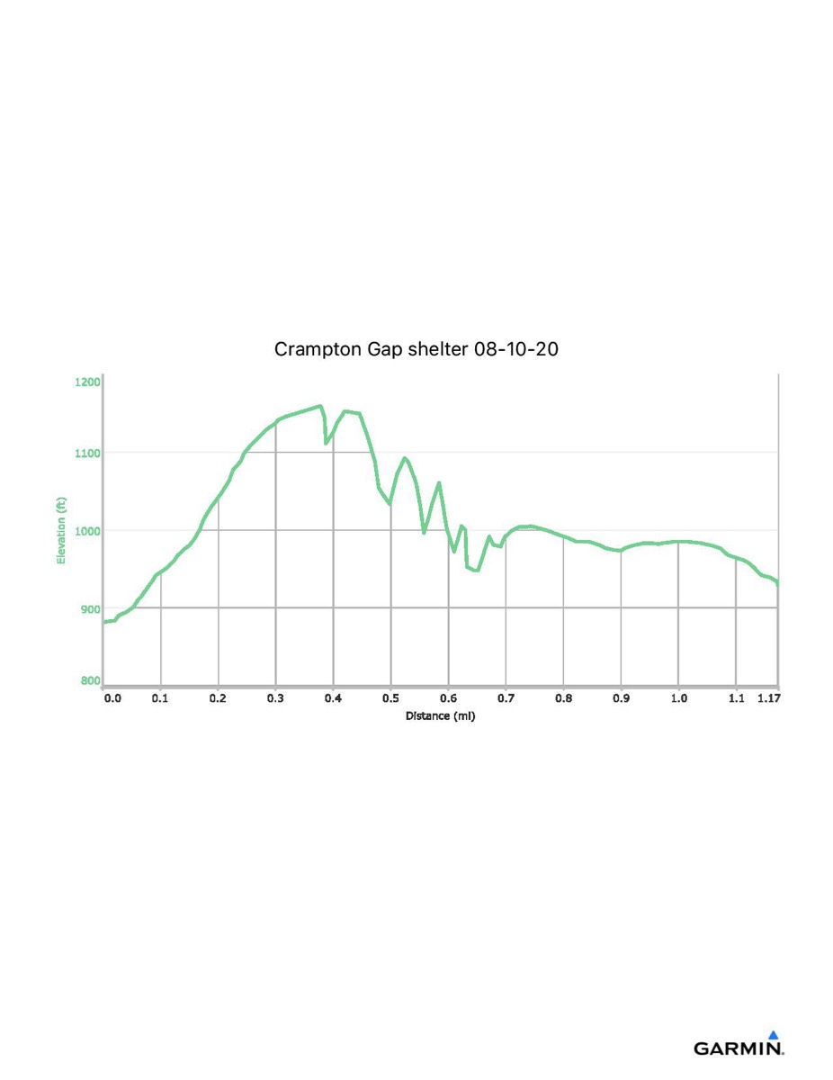
Distance - 1.2 mi
Time - 0:41
Total Ascent - 513 ft
Total Descent - 463 ft
Max Elevation - 1161 ft
Min Elevation - 873 ft
I parked at Gathland State Park and walked north along the trail to the shelter. To return, I followed an unmarked old road which leads directly (and fairly level) back to Gathland.
Built 1941 by CCC
Next shelter NB: Rocky Run shelter, 5.0 miles
Next shelter SB: Ed Garvey shelter, 4.1 miles
Distance - 1.2 mi
Time - 0:41
Total Ascent - 513 ft
Total Descent - 463 ft
Max Elevation - 1161 ft
Min Elevation - 873 ft
I parked at Gathland State Park and walked north along the trail to the shelter. To return, I followed an unmarked old road which leads directly (and fairly level) back to Gathland.