Raven Rock Shelter
The turnoff for Raven Rock shelter is located about 1.8 miles south of High Rock. The shelter is about 0.1 mile west off the trail. We pass this shelter during the MD AT #2 hike. As it comes so early in the hike, we usually have just a short rest stop here before continuing to have lunch further down the trail. There is one lean-to structure with a picnic table on its covered porch, several benches around a fire circle. There are a small number of camping spaces nearby. The elevated, composting privy is located a short distance from the shelter. A marked trail on the opposite (east) side of the AT from the shelter leads steeply downhill to two springs. The first spring, left and slightly uphill of the blue trail is just a small hole. The second spring, to the right and about 10 yards downhill, is larger and feeds a running water source. These springs formerly served the Devils Racecourse shelter which was located here near the springs. The Devil's Racecourse shelter was removed after construction of Raven Rock shelter. Raven Rock is one of the four "new" Maryland shelters, all built since 2000.
Built 2010
Next shelter NB: Deer Lick shelter, 9.6 miles
Next shelter SB: Ensign Cowall shelter, 4.9 miles
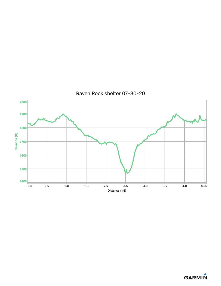
Distance - 4.6 mi
Time - 2:12
Total Ascent - 801 ft
Total Descent - 771 ft
Max Elevation - 1903 ft
Min Elevation - 1467 ft
I parked at High Rock and walked along the blue trail to the AT, then south along the trail to the shelter. Returning, I took the alternate access trail back to High Rock. This track shows some vertical drift and may be redone.
Built 2010
Next shelter NB: Deer Lick shelter, 9.6 miles
Next shelter SB: Ensign Cowall shelter, 4.9 miles
Distance - 4.6 mi
Time - 2:12
Total Ascent - 801 ft
Total Descent - 771 ft
Max Elevation - 1903 ft
Min Elevation - 1467 ft
I parked at High Rock and walked along the blue trail to the AT, then south along the trail to the shelter. Returning, I took the alternate access trail back to High Rock. This track shows some vertical drift and may be redone.