Antietam Shelter (removed)
Antietam shelter was located about 0.1 miles south of the Old Forge picnic area. We used to pass this shelter during the PA AT #1 hike just after having lunch at Old Forge. We seldom stopped here except for a brief photo op. The shelter is just across Antietam Creek from the trail, accessible by a footbridge. There was one lean-to structures, a picnic table and a fire ring. There was no privy as Old Forge is only a five minute walk away. Although Antietam Creek provided an abundant water source, the trail guide recommends against using it, suggesting to get water from Old Forge, which has a year-round water tap.
Built 1936 by Civilian Conservation Corps (CCC)
Dismantled 2019 and moved to Cowans Gap State Park, Fort Loudon, PA
Next shelter NB: Tumbling Run shelter, 1.2 miles
Next shelter SB: Deer Lick Run shelter, 2.4 miles
Distance - 0.4 mi
Time - 0:12
Total Ascent - 12 ft
Total Descent - 11 ft
Max Elevation - 255 ft
Min Elevation - 243 ft
I parked at the Old Forge picnic area and walked south along the trail to the shelter. From the same parking spot, I also visited the Tumbling Run shelter.
Built 1936 by Civilian Conservation Corps (CCC)
Dismantled 2019 and moved to Cowans Gap State Park, Fort Loudon, PA
Next shelter NB: Tumbling Run shelter, 1.2 miles
Next shelter SB: Deer Lick Run shelter, 2.4 miles
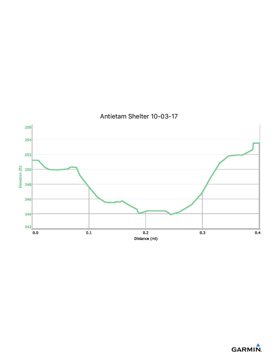
Distance - 0.4 mi
Time - 0:12
Total Ascent - 12 ft
Total Descent - 11 ft
Max Elevation - 255 ft
Min Elevation - 243 ft
I parked at the Old Forge picnic area and walked south along the trail to the shelter. From the same parking spot, I also visited the Tumbling Run shelter.