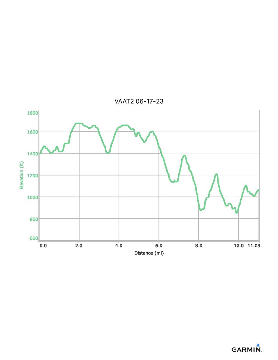
Virginia Appalachian Trail #2, 6-17-2023
Distance - 11.0 mi
Time - 5:50
Total Ascent - 1735 ft
Total Descent - 2071 ft
Max Elevation - 1676 ft
Min Elevation - 852 ft
Note: This hike was longer than usual because, due to limited parking, we had to cross Rt 7 and walk up to the Snickers Gap parking lot.
Time - 5:50
Total Ascent - 1735 ft
Total Descent - 2071 ft
Max Elevation - 1676 ft
Min Elevation - 852 ft
Note: This hike was longer than usual because, due to limited parking, we had to cross Rt 7 and walk up to the Snickers Gap parking lot.