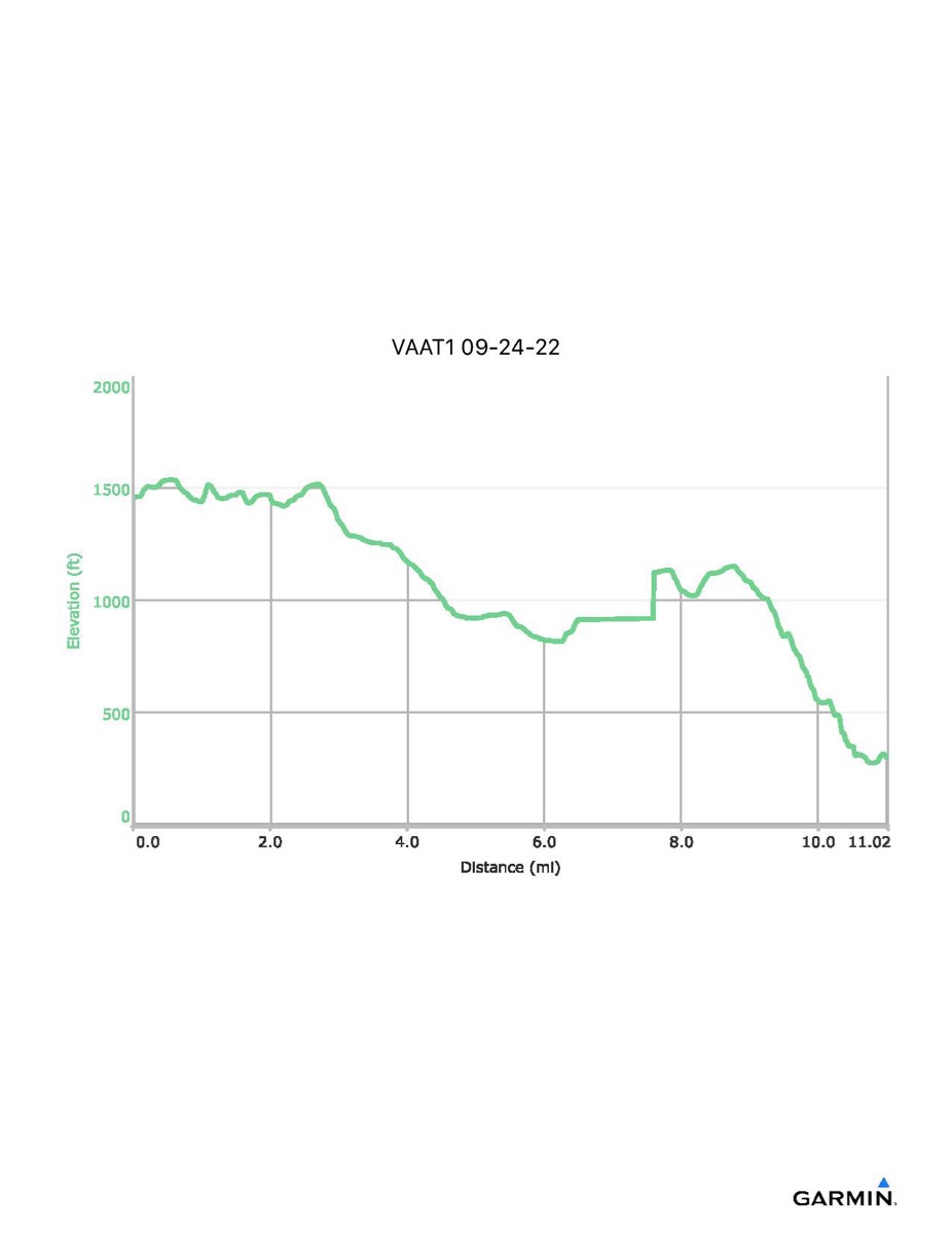
Virginia Appalachian Trail #1, 9-24-2022
NOTE: For some reason, my GPS paused between mile 6.4 and 7.6. The distance and elevation figures will not be accurate and the map and elevation profile will reflect this missing section.
Distance - 11.0 mi
Time - 7:05
Total Ascent - 866 ft
Total Descent - 2025 ft
Max Elevation - 1537 ft
Min Elevation - 273 ft
Distance - 11.0 mi
Time - 7:05
Total Ascent - 866 ft
Total Descent - 2025 ft
Max Elevation - 1537 ft
Min Elevation - 273 ft