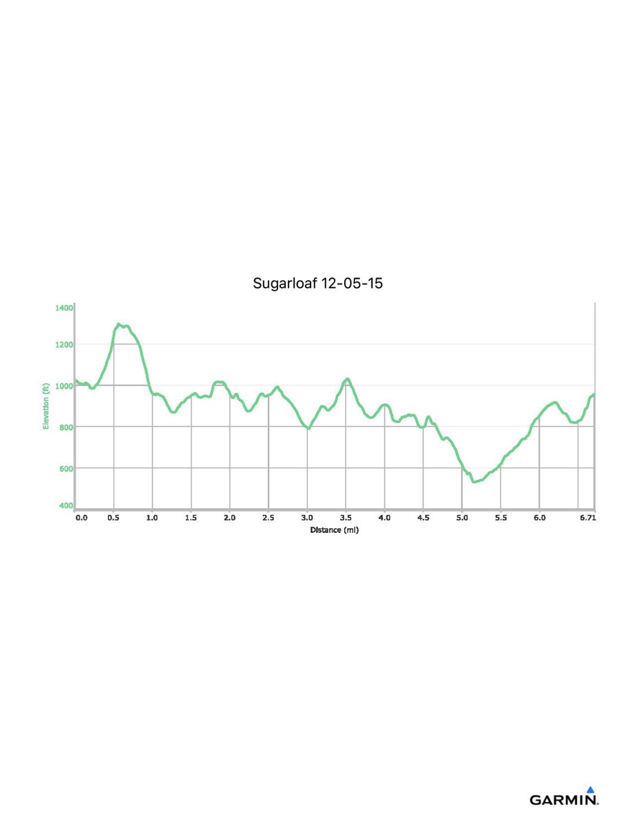
Sugarloaf Mountain, 12-5-2015
Distance - 6.7 mi
Time - 4:32
Total Ascent - 1614 ft
Total Descent - 1676 ft
Max Elevation - 1300 ft
Min Elevation - 529 ft
Note: With many trails here, the exact route may vary.
Time - 4:32
Total Ascent - 1614 ft
Total Descent - 1676 ft
Max Elevation - 1300 ft
Min Elevation - 529 ft
Note: With many trails here, the exact route may vary.