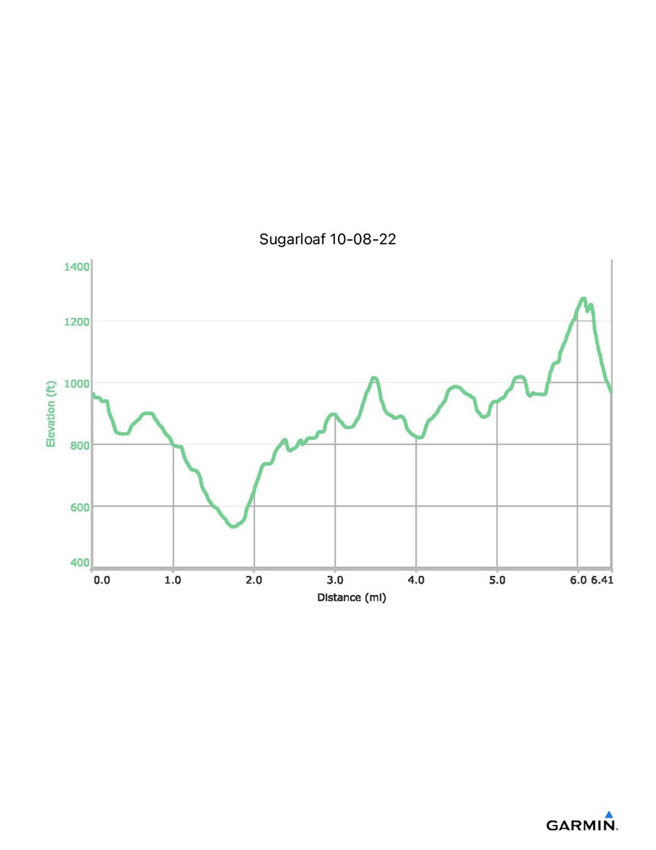
Sugarloaf Mountain, 10-8-2022
Distance - 6.4 mi
Time - 4:26
Total Ascent - 1284 ft
Total Descent - 1278 ft
Max Elevation - 1274 ft
Min Elevation - 533 ft
Note: With many trails here, the exact route may vary.
Time - 4:26
Total Ascent - 1284 ft
Total Descent - 1278 ft
Max Elevation - 1274 ft
Min Elevation - 533 ft
Note: With many trails here, the exact route may vary.