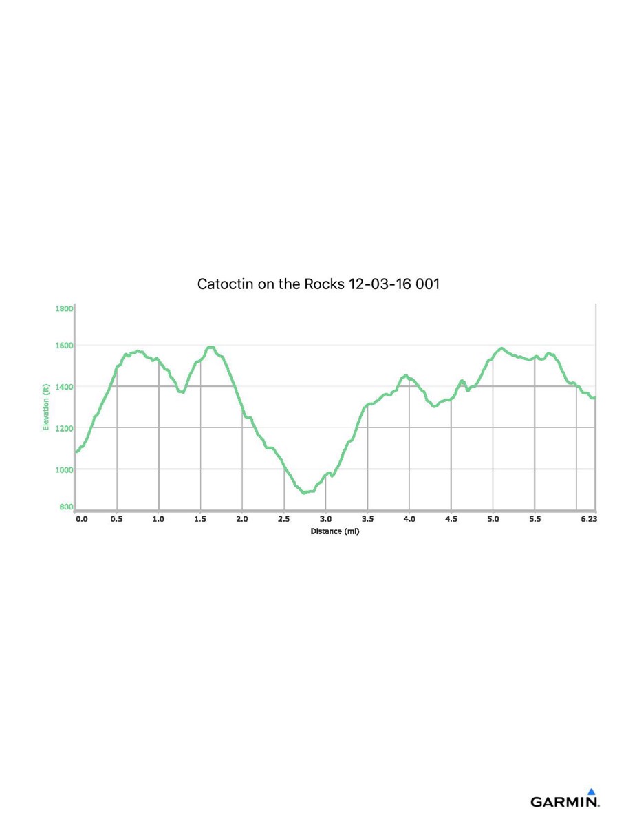
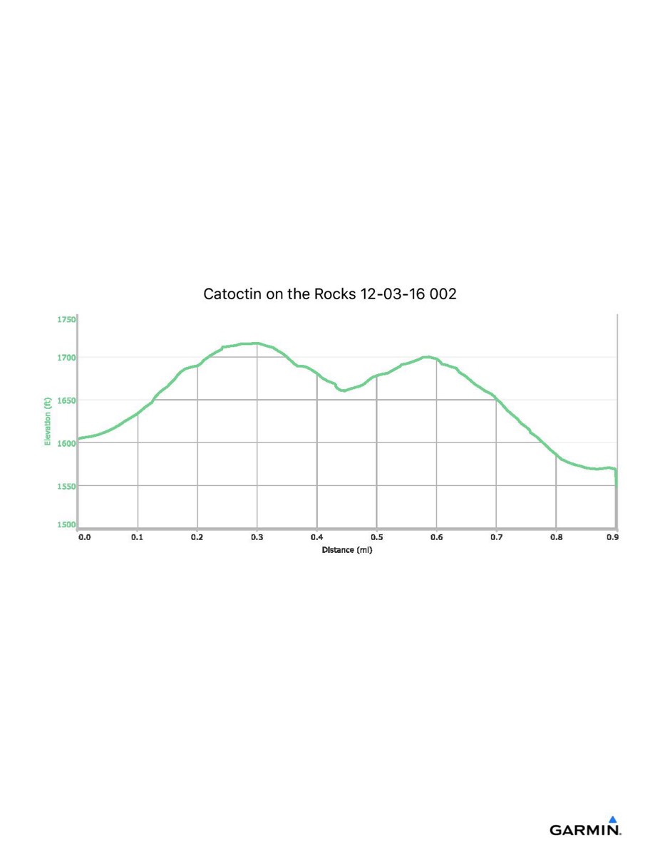
Catoctin On The Rocks, 12-3-2016
Distance - 6.2/0.9 mi
Time - 4:18/0:30
Total Ascent - 1718/153 ft
Total Descent - 1453/193 ft
Max Elevation - 1592/1718 ft
Min Elevation - 882/1546 ft
Time - 4:18/0:30
Total Ascent - 1718/153 ft
Total Descent - 1453/193 ft
Max Elevation - 1592/1718 ft
Min Elevation - 882/1546 ft
Click on square at upper-right of map to open in full-page view.
Click on the profile to download it as a pdf file