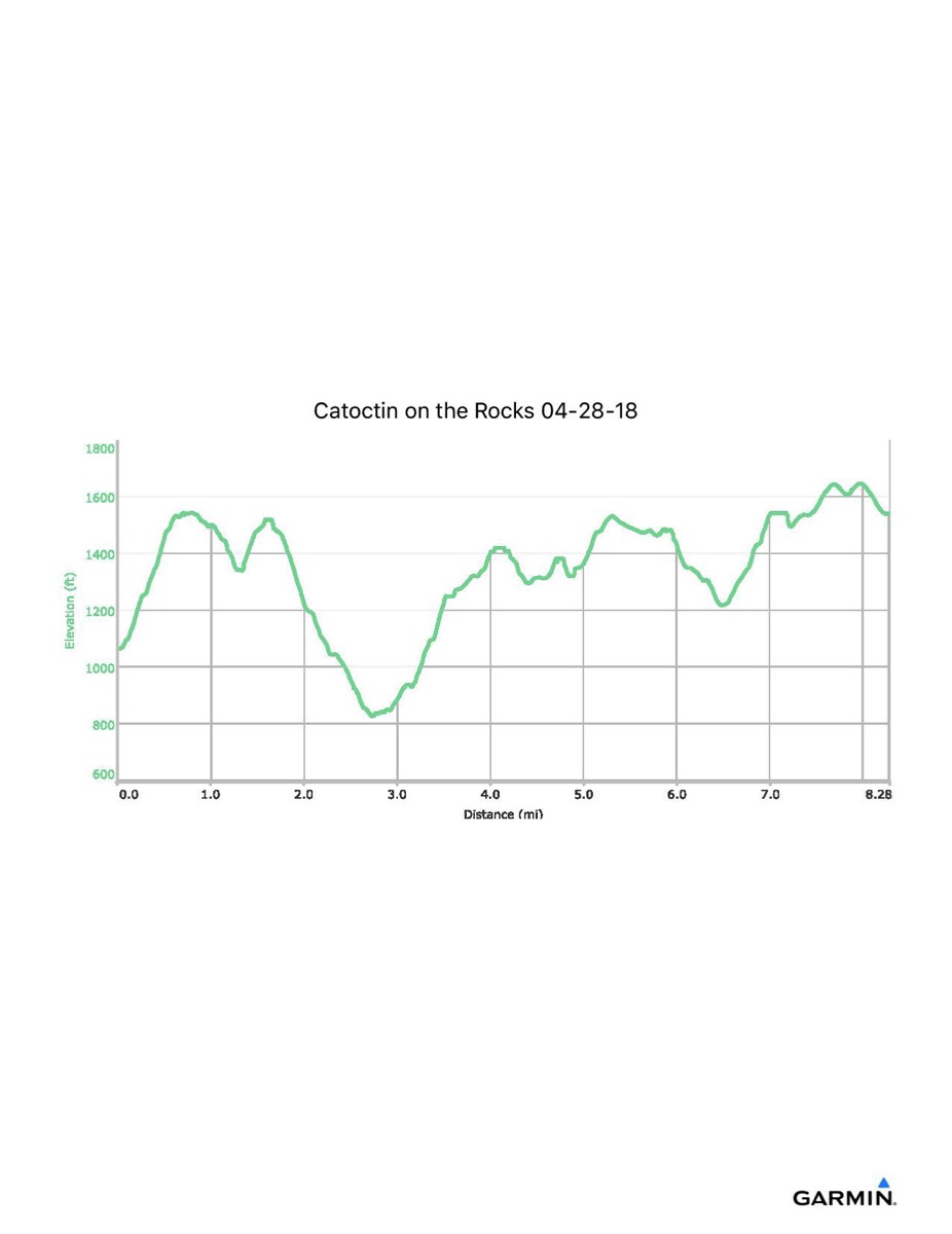
Catoctin on the Rocks, 4-28-2018
Distance - 8.3 mi
Time - 5:45
Total Ascent - 2149 ft
Total Descent - 1673 ft
Max Elevation - 1648 ft
Min Elevation - 825 ft
Note: These numbers reflect what I walked with the GPS. If you did not go to Hog Rock, subtract: 26 minutes, 0.9 miles, 150 ft of ascent/descent, and your max elevation was only 1547 ft. If you did not walk out onto Wolf Rock, subtract: 0.2 miles and 60 ft of ascent/descent.