Catoctin On The Rocks, 4-23-2022
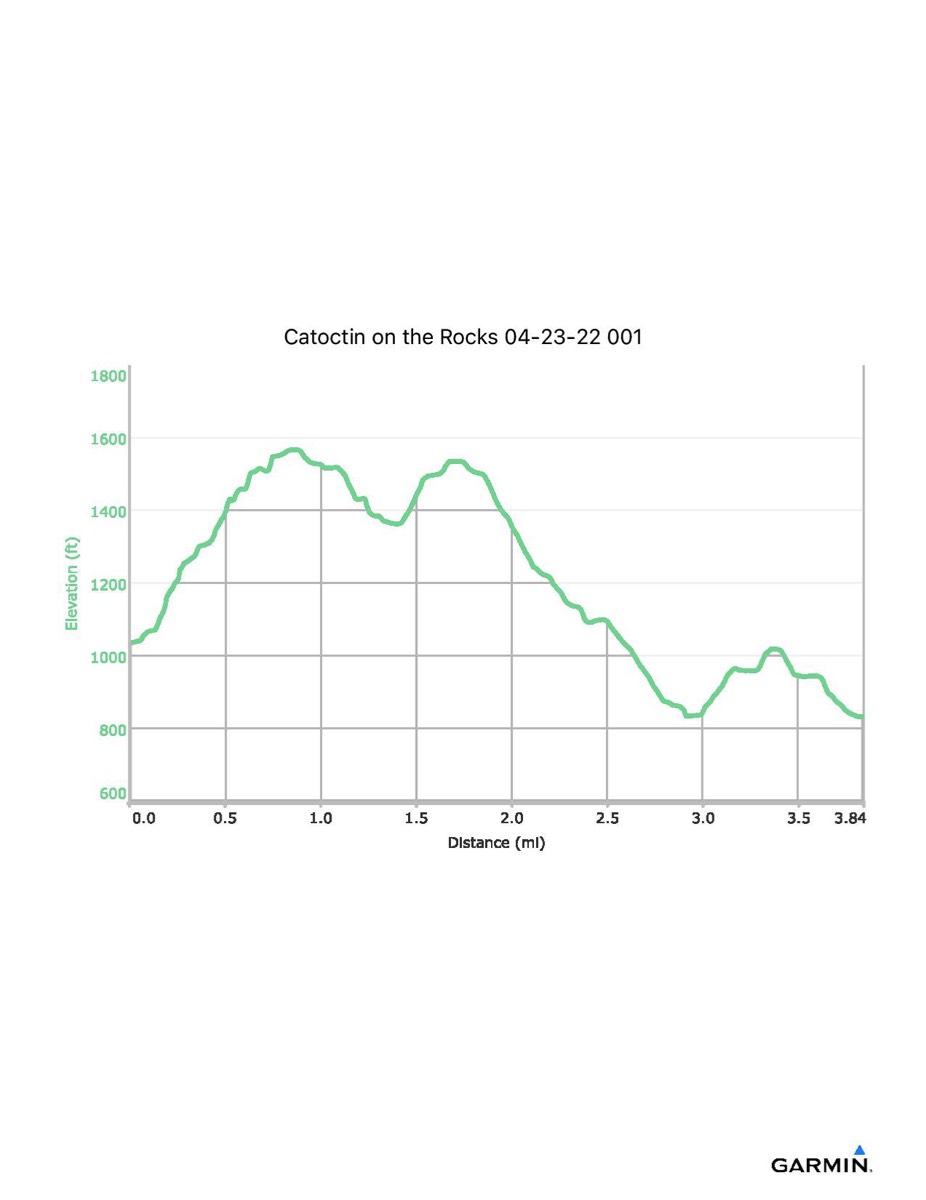
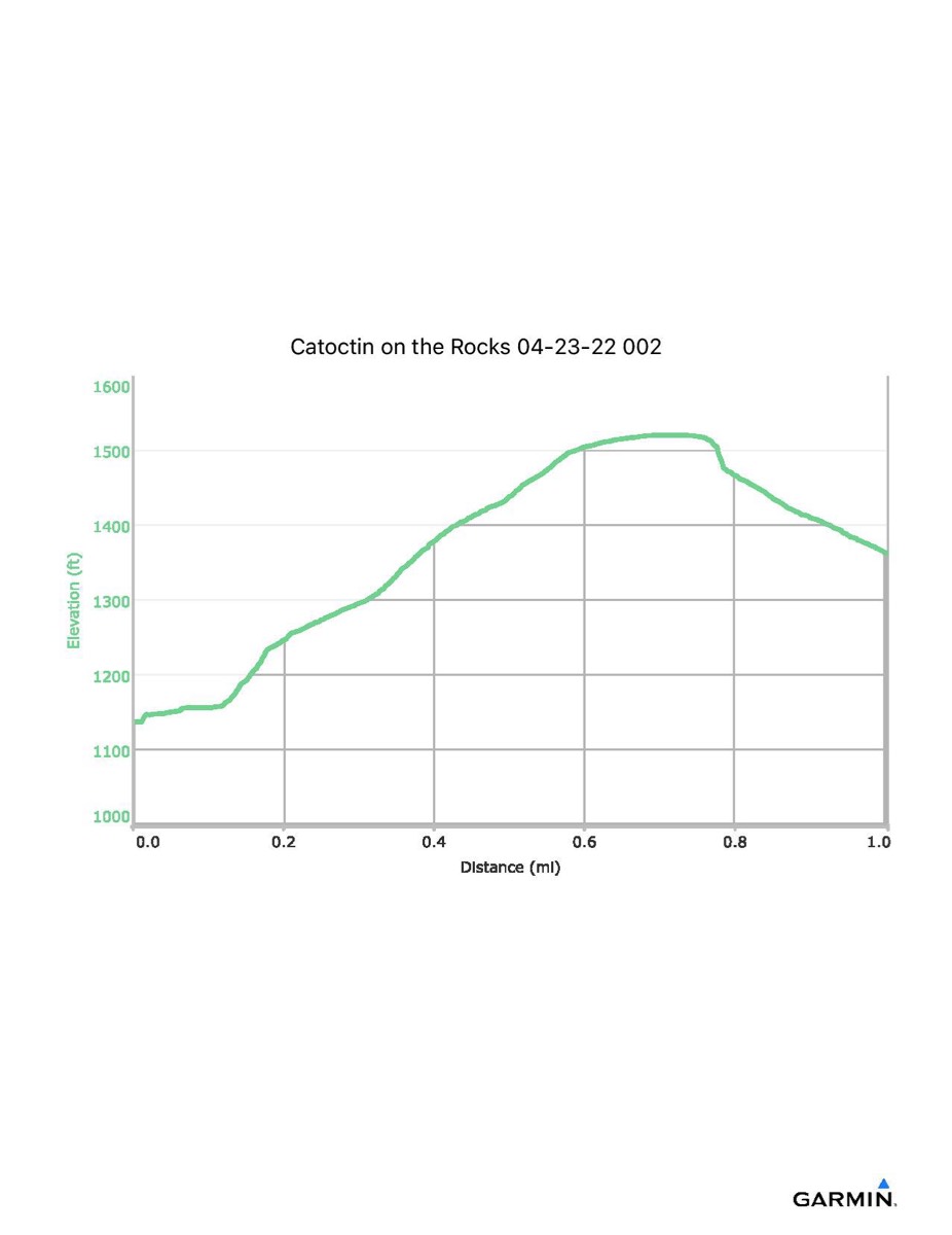
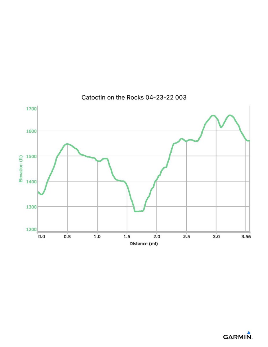
NOTE: This map and associated data ARE NOT TYPICAL of this hike. Please refer to one of the other instances of this hike if you want to see what the hike is like in its entirety. On this hike, one hiker was unable to continue so I escorted that hiker back to the road where we were picked up by one of the vans. I was then dropped off at another trailhead to rejoin the group. The data listed below is for three parts: the first section until I turned around and the van picked us up, my solo hike back to link up with the group, and the group hike from that point (Wolf Rock) to the end. The max and min elevation numbers are for the entire hike. The total time for the entire hike was 5:45.
Distance - 3.8/1.0/3.6 mi
Time - 2:53/0:29/2:08
Total Ascent - 916/392/656 ft
Total Descent - 1117/159/452 ft
Max Elevation - 1662 ft (if you did not go to Hog Rock your max elevation was 1567 ft)
Min Elevation - 831 ft
Distance - 3.8/1.0/3.6 mi
Time - 2:53/0:29/2:08
Total Ascent - 916/392/656 ft
Total Descent - 1117/159/452 ft
Max Elevation - 1662 ft (if you did not go to Hog Rock your max elevation was 1567 ft)
Min Elevation - 831 ft
Click on square at upper-right of map to open in full-page view.
Download GPX file first part/second part/third part.
Download KML file first part/second part/third part.
Click on the profile to download it as a pdf file