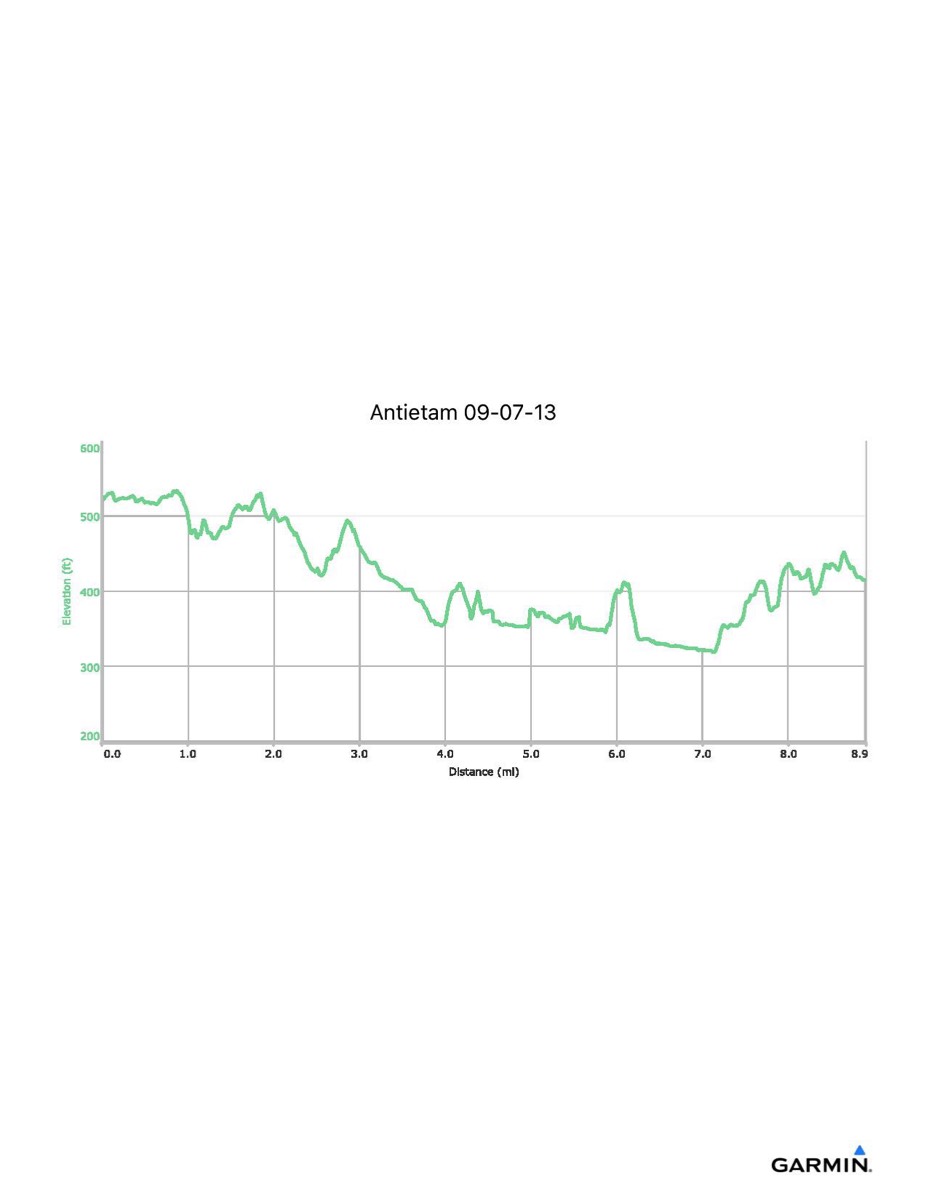
Antietam Battlefield, 9-7-2013
Distance - 8.9 mi
Time - 4:43
Total Ascent - 746 ft
Total Descent - 858 ft
Max Elevation - 535 ft
Min Elevation - 317 ft
Note: exact route of hike may vary
Time - 4:43
Total Ascent - 746 ft
Total Descent - 858 ft
Max Elevation - 535 ft
Min Elevation - 317 ft
Note: exact route of hike may vary