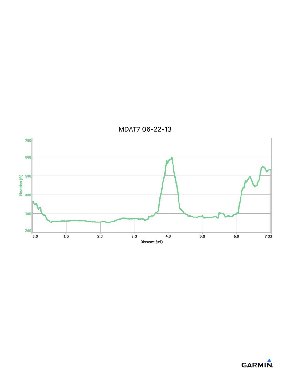
Maryland Appalachian Trail #7, 6-22-2013
Distance - 7.0 mi
Time - no time data for this hike
Total Ascent - 1128 ft
Total Descent - 949 ft
Max Elevation - 600 ft
Min Elevation - 250 ft
NOTE: Actual mileage will vary depending on whether you make the side trip to Maryland Heights and how much walking around Harpers Ferry. This track includes the final walk to ATC headquarters following the AT out of Harpers Ferry.