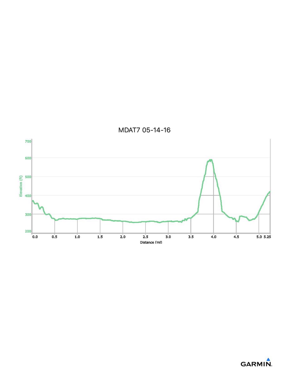
Maryland Appalachian Trail #7, 5-14-2016
Distance - 5.5 mi
Time - 3:45
Total Ascent - 718 ft
Total Descent - 563 ft
Max Elevation - 590 ft
Min Elevation - 254 ft
Note: profile shown ends when GPS battery ran out and does not include last 0.3 mile and 100 feet elevation
Time - 3:45
Total Ascent - 718 ft
Total Descent - 563 ft
Max Elevation - 590 ft
Min Elevation - 254 ft
Note: profile shown ends when GPS battery ran out and does not include last 0.3 mile and 100 feet elevation