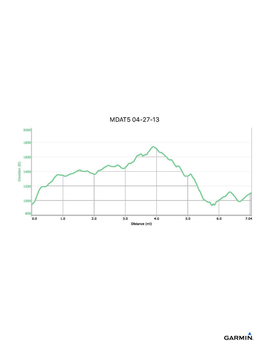
Maryland Appalachian Trail #5, 4-27-2013
Distance - 7.0 mi
Time - 4:05
Total Ascent - 1362 ft
Total Descent - 1202 ft
Max Elevation - 1740 ft
Min Elevation - 931 ft
Note: this hike ran S-N (Gathland SP - Reno Monument)
Time - 4:05
Total Ascent - 1362 ft
Total Descent - 1202 ft
Max Elevation - 1740 ft
Min Elevation - 931 ft
Note: this hike ran S-N (Gathland SP - Reno Monument)