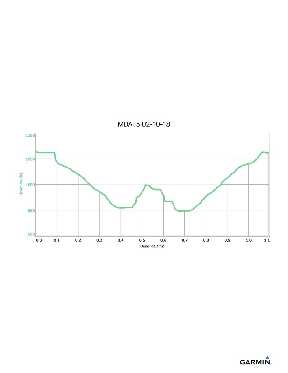
Maryland Appalachian Trail #5, 2-10-2018
Distance - 1.3 mi
Time - 1:03
Total Ascent - 151 ft
Total Descent - 153 ft
Max Elevation - 1070 ft
Min Elevation - 948 ft
Note: this hike was abandoned due to icy trail conditions
Time - 1:03
Total Ascent - 151 ft
Total Descent - 153 ft
Max Elevation - 1070 ft
Min Elevation - 948 ft
Note: this hike was abandoned due to icy trail conditions