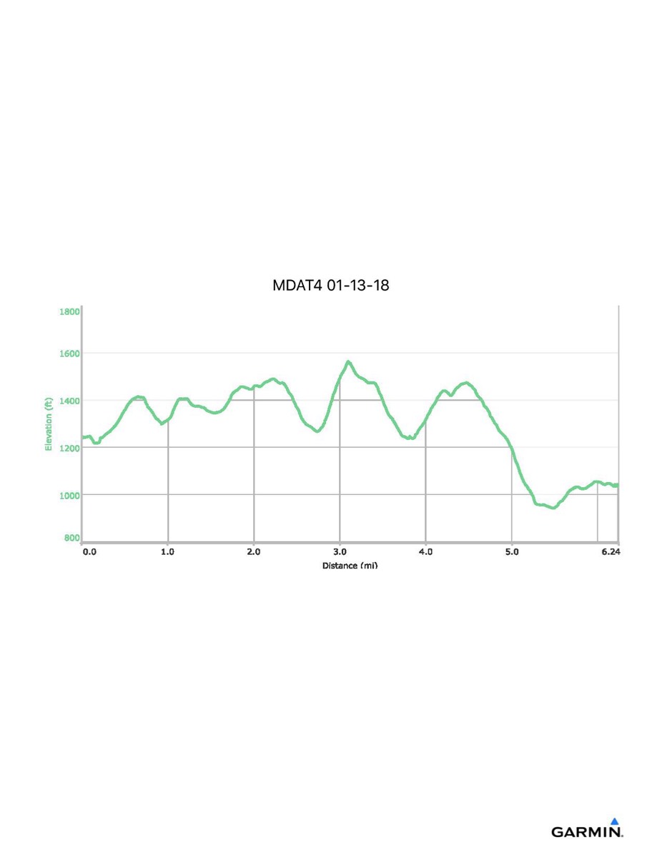
Maryland Appalachian Trail #4, 1-13-2018
Distance - 6.6 mi
Time - 3:36
Total Ascent - 1283 ft
Total Descent - 1484 ft
Max Elevation - 1561 ft
Min Elevation - 938 ft
Note: this hike ran N-S (Rt 40 - Reno Monument)
Time - 3:36
Total Ascent - 1283 ft
Total Descent - 1484 ft
Max Elevation - 1561 ft
Min Elevation - 938 ft
Note: this hike ran N-S (Rt 40 - Reno Monument)