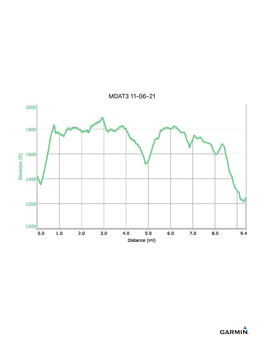
Maryland Appalachian Trail #3, 11–6-2021
Distance - 9.4 mi
Time - 5:20
Total Ascent - 1457 ft
Total Descent - 1621 ft
Max Elevation - 1893 ft
Min Elevation - 1214 ft
Time - 5:20
Total Ascent - 1457 ft
Total Descent - 1621 ft
Max Elevation - 1893 ft
Min Elevation - 1214 ft