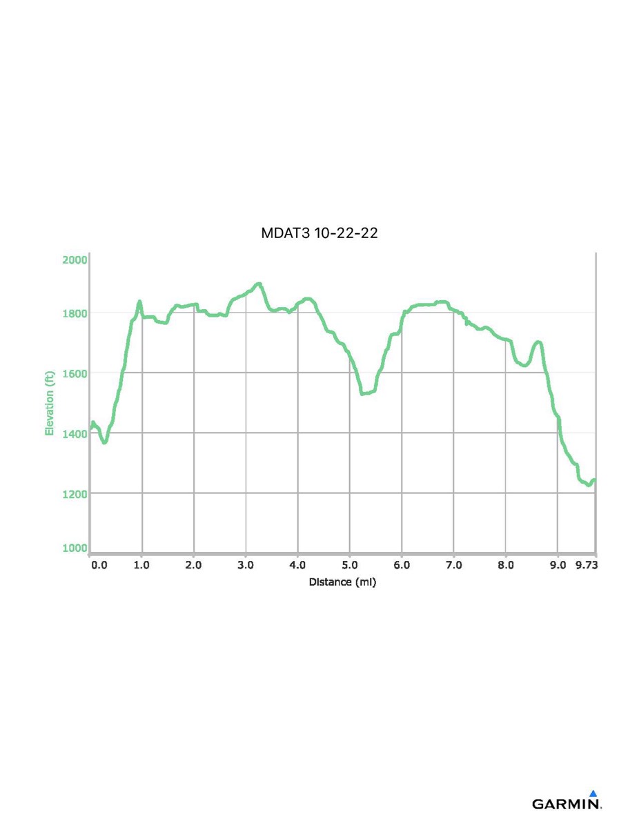
Maryland Appalachian Trail #3, 10–22-2022
Distance - 9.7 mi
Time - 5:22
Total Ascent - 1149 ft
Total Descent - 1320 ft
Max Elevation - 1897 ft
Min Elevation - 1225 ft
NOTE: These numbers do not include the side trip to Annapolis Rocks so your totals may be slightly larger.
Time - 5:22
Total Ascent - 1149 ft
Total Descent - 1320 ft
Max Elevation - 1897 ft
Min Elevation - 1225 ft
NOTE: These numbers do not include the side trip to Annapolis Rocks so your totals may be slightly larger.