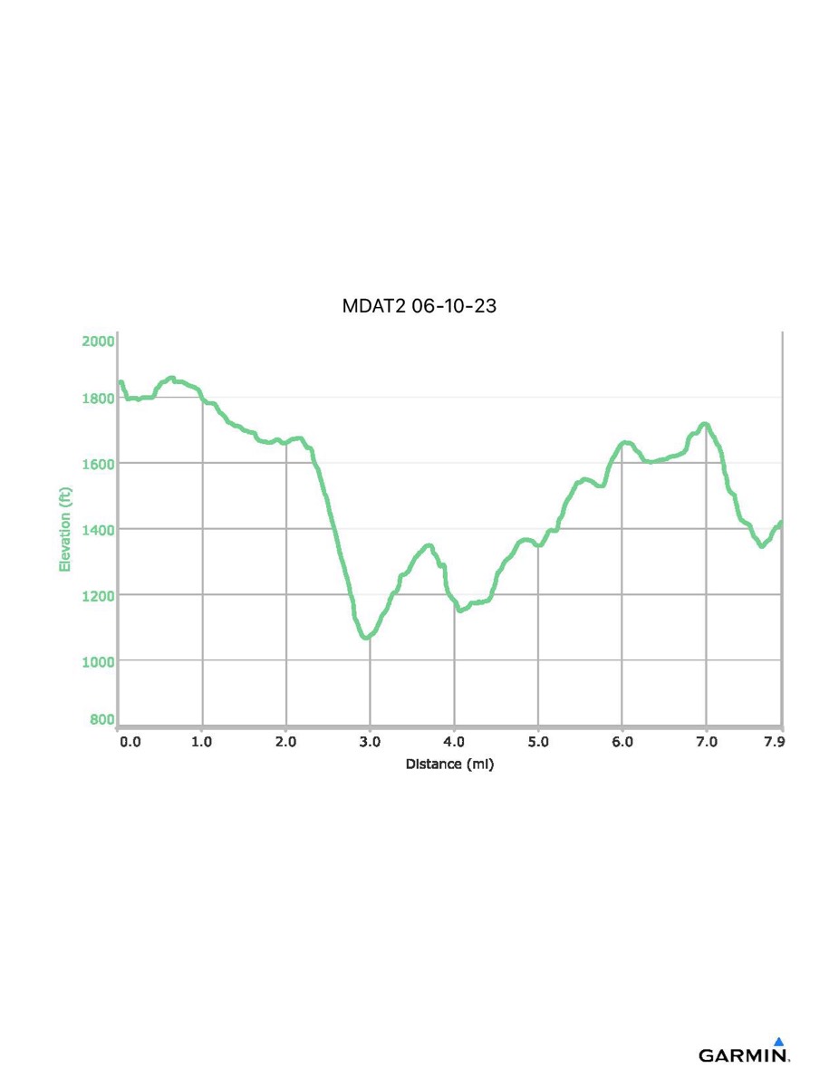
Maryland Appalachian Trail #2, 6-10-2023
Distance - 7.9 (8.2) mi
Time - 4:25 (4:35)
Total Ascent - 1135 (1207) ft
Total Descent - 1557 ft
Max Elevation - 1860 ft
Min Elevation - 1067 ft
I forgot to turn on my GPS until we were about 0.3 miles into the hike. The data files and profile below only include the part that I recorded. The numbers in parentheses above attempt to estimate the total distance and time including the part I missed. The map below attempts to trace in the part I missed.