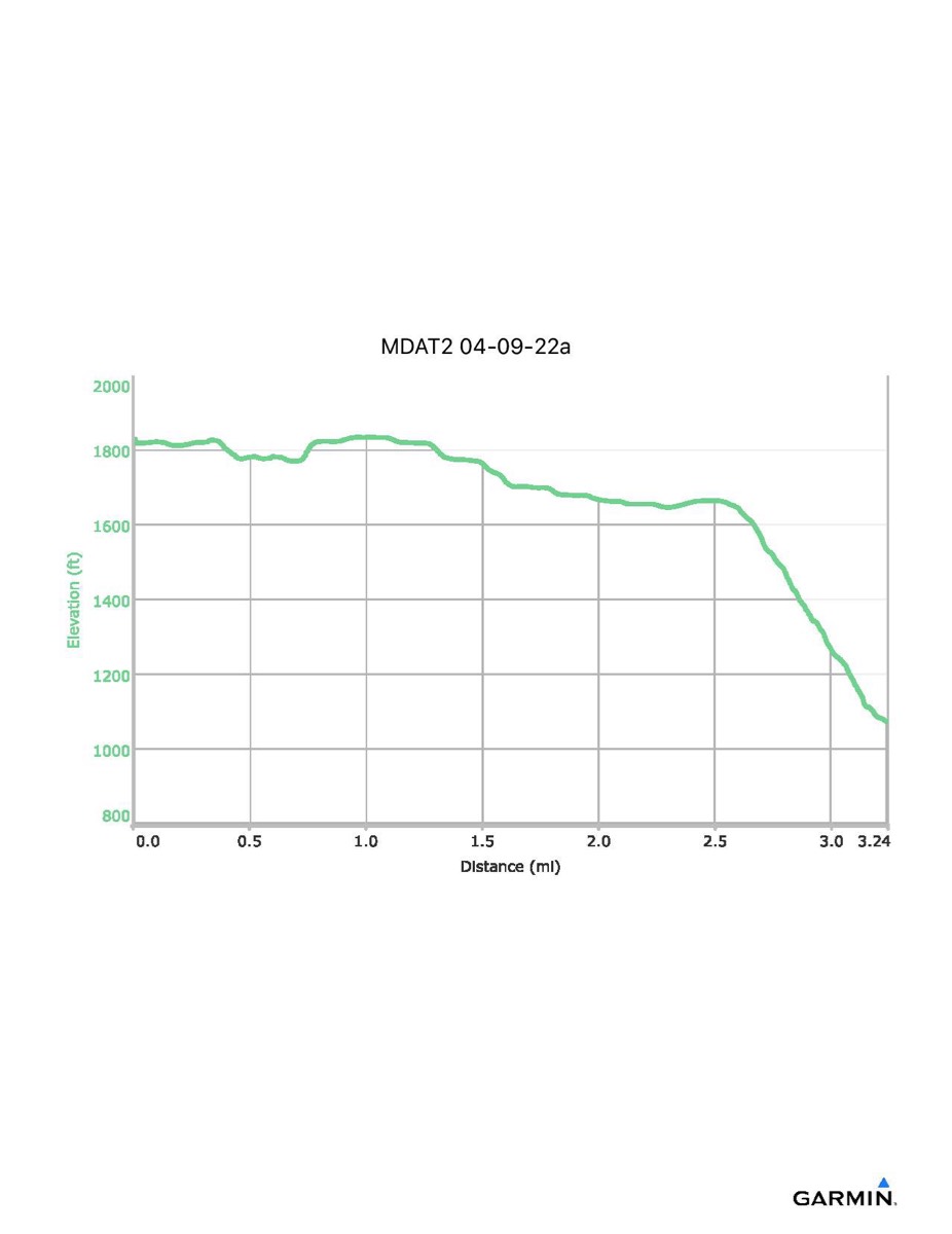
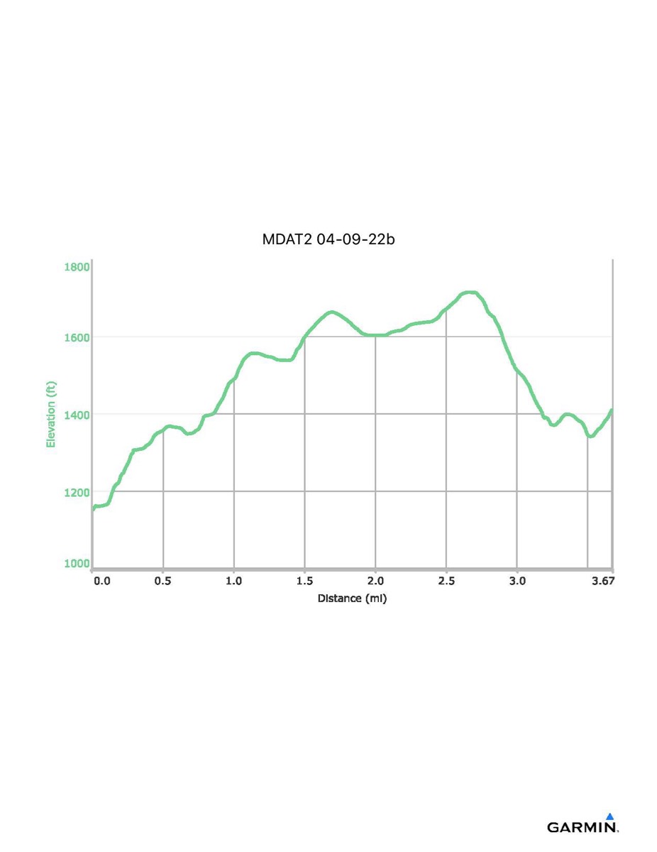
Maryland Appalachian Trail #2, 4-9-2022
Distance - 3.2/3.7 mi
Time - 1:42/2:10
Total Ascent - 112/761 ft
Total Descent - 874/498 ft
Max Elevation - 1835/1715 ft
Min Elevation - 1072/1151 ft
Because of high water on Little Antietam Creek, we had to use a van shuttle between Raven Rock Road and Warner Hollow Road. This divided the hike into two parts. In the above data, the first number given is for the first part of the hike and the second number is for the second part of the hike. The total hike time, including the van shuttle, was 4:22. Using the van shuttle cut out roughly 0.95 trail miles and a short climb over the hill between the two creeks.
Click on square at upper-right of map to open in full-page view.
Click on the profile to download it as a pdf file