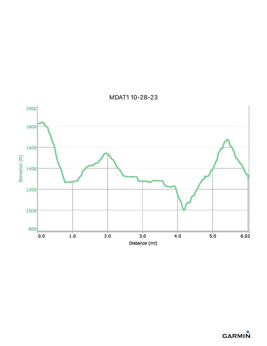
Maryland Appalachian Trail #1, 10-28-2023
Distance - 6.0 (6.3) mi
Time - 4:02
Total Ascent - 1005 (1008) ft
Total Descent - 1537 (1662) ft
Max Elevation - 1825 ft
Min Elevation - 999 ft
NOTE: The track data files and profile do not include the entire hike. They stop at Old Route 16 where I stopped with an injured hiker. The approximate total numbers are given above in parenthesis and the final hike portion (which I did not do) is indicated in blue on the map below.