Maryland Appalachian Trail #1, 4-14-2018 (partial)
NOTE: This track does not cover the entire hike route, so these numbers do not reflect the entire hike distance. See other years for more complete data.
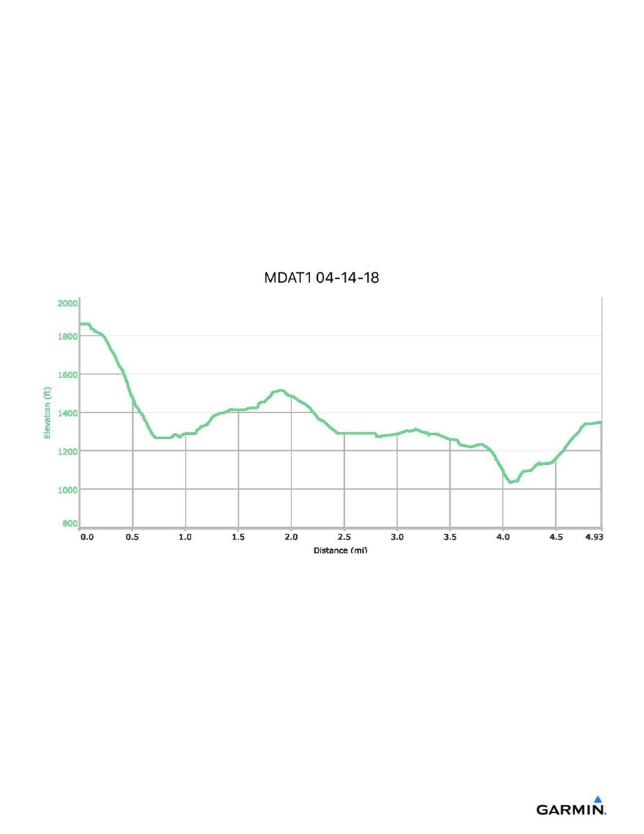
Distance - 4.9 mi
Time - 4:08
Total Ascent - 656 ft
Total Descent - 1167 ft
Max Elevation - 1862 ft
Min Elevation - 1034 ft
Distance - 4.9 mi
Time - 4:08
Total Ascent - 656 ft
Total Descent - 1167 ft
Max Elevation - 1862 ft
Min Elevation - 1034 ft