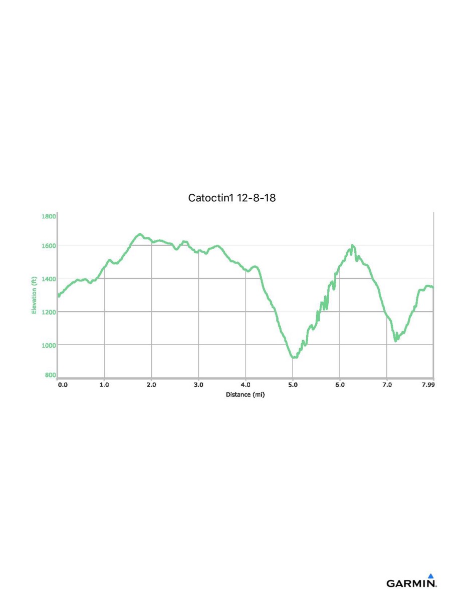
Catoctin Trail #1, 12–8-2018
Distance - 8.0 mi
Time - 4:24
Total Ascent - 1966 ft
Total Descent - 1937 ft
Max Elevation - 1669 ft
Min Elevation - 919 ft
Time - 4:24
Total Ascent - 1966 ft
Total Descent - 1937 ft
Max Elevation - 1669 ft
Min Elevation - 919 ft