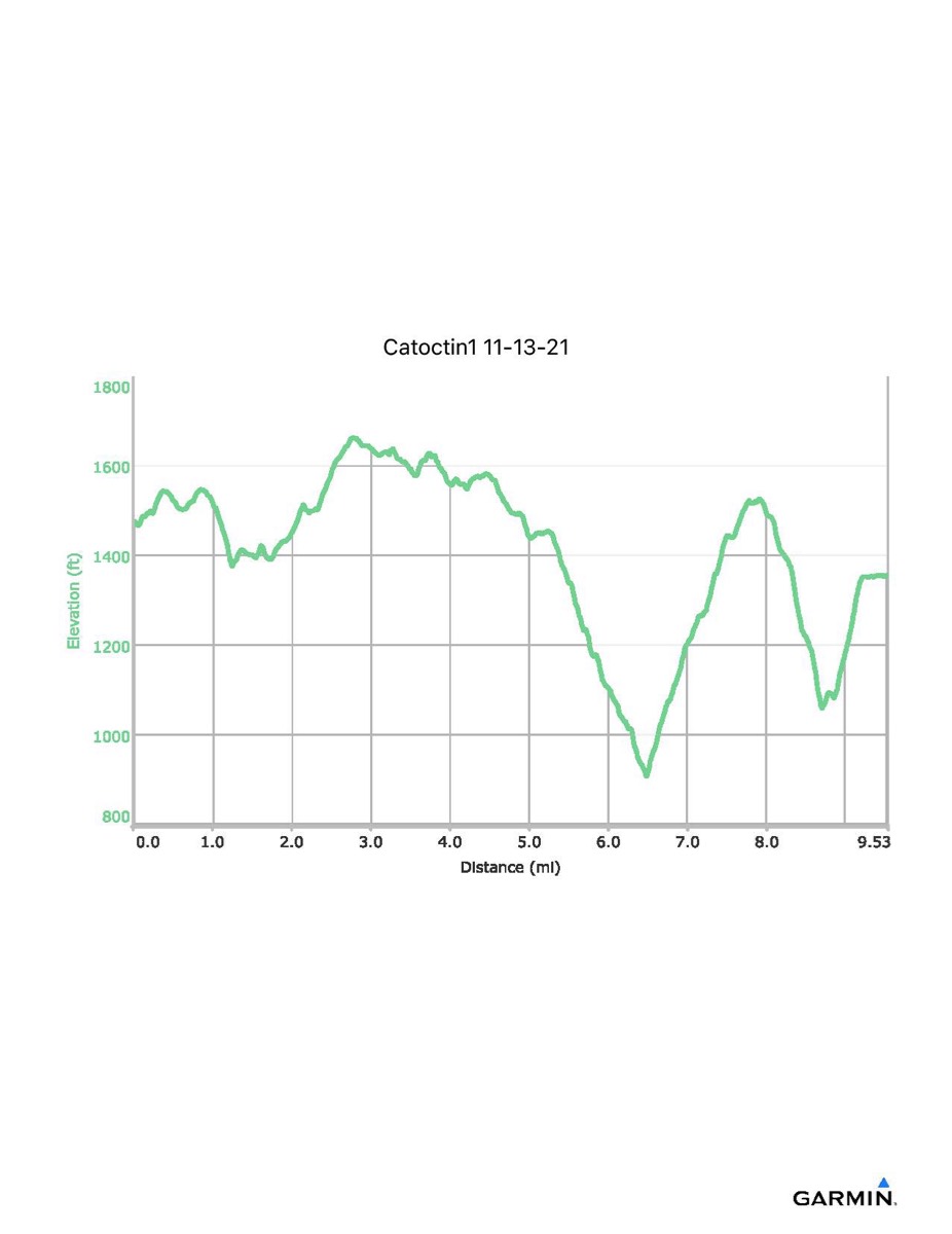
Catoctin Trail #1, 11–13-2021
Distance - 9.5 mi
Time - 5:17
Total Ascent - 1623 ft
Total Descent - 1741 ft
Max Elevation - 1663 ft
Min Elevation - 906 ft
NB: This hike uses a new trailhead from previous years
Time - 5:17
Total Ascent - 1623 ft
Total Descent - 1741 ft
Max Elevation - 1663 ft
Min Elevation - 906 ft
NB: This hike uses a new trailhead from previous years