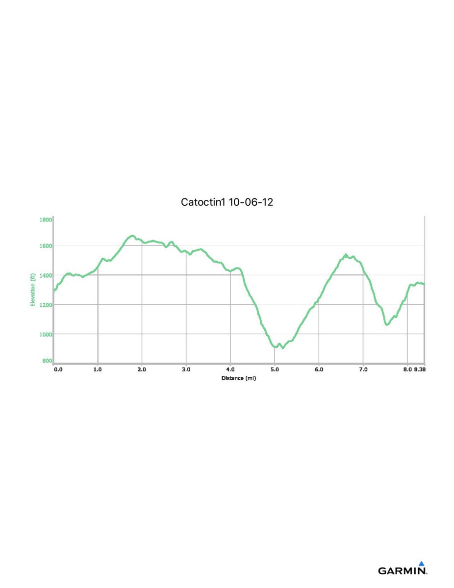
Catoctin Trail #1, 10-6-2012
Distance - 8.4 mi
Time - 4:20
Total Ascent - 1564 ft
Total Descent - 1495 ft
Max Elevation - 1666 ft
Min Elevation - 901 ft
Time - 4:20
Total Ascent - 1564 ft
Total Descent - 1495 ft
Max Elevation - 1666 ft
Min Elevation - 901 ft