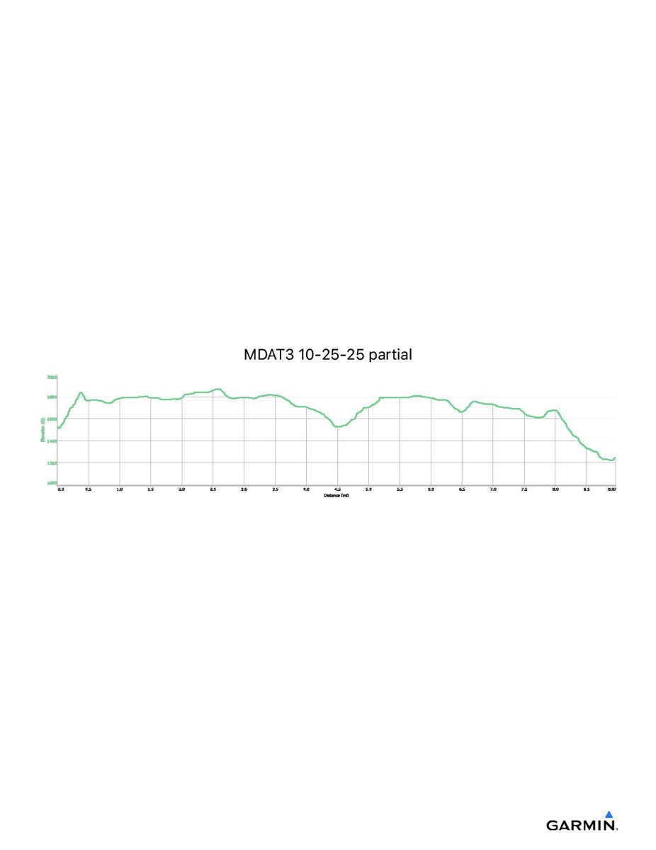
Maryland Appalachian Trail #3, 10–25-2025
Distance - 9.3 mi
Time - 5:26
Total Ascent - 1142 ft
Total Descent - 1316 ft
Max Elevation - 1869 ft
Min Elevation - 1221 ft
NOTE: I forgot to turn on my GPS tracker until about 12 minutes into the hike so the include GPX/KML files will show slightly less than the above totals)
Time - 5:26
Total Ascent - 1142 ft
Total Descent - 1316 ft
Max Elevation - 1869 ft
Min Elevation - 1221 ft
NOTE: I forgot to turn on my GPS tracker until about 12 minutes into the hike so the include GPX/KML files will show slightly less than the above totals)